NISAR: Payload of World’s Costliest Satellite, Jointly Developed by India, US, to Reach India on Feb
Edited By: Shankhyaneel Sarkar
Last Updated: January 31, 2023, 12:54 IST
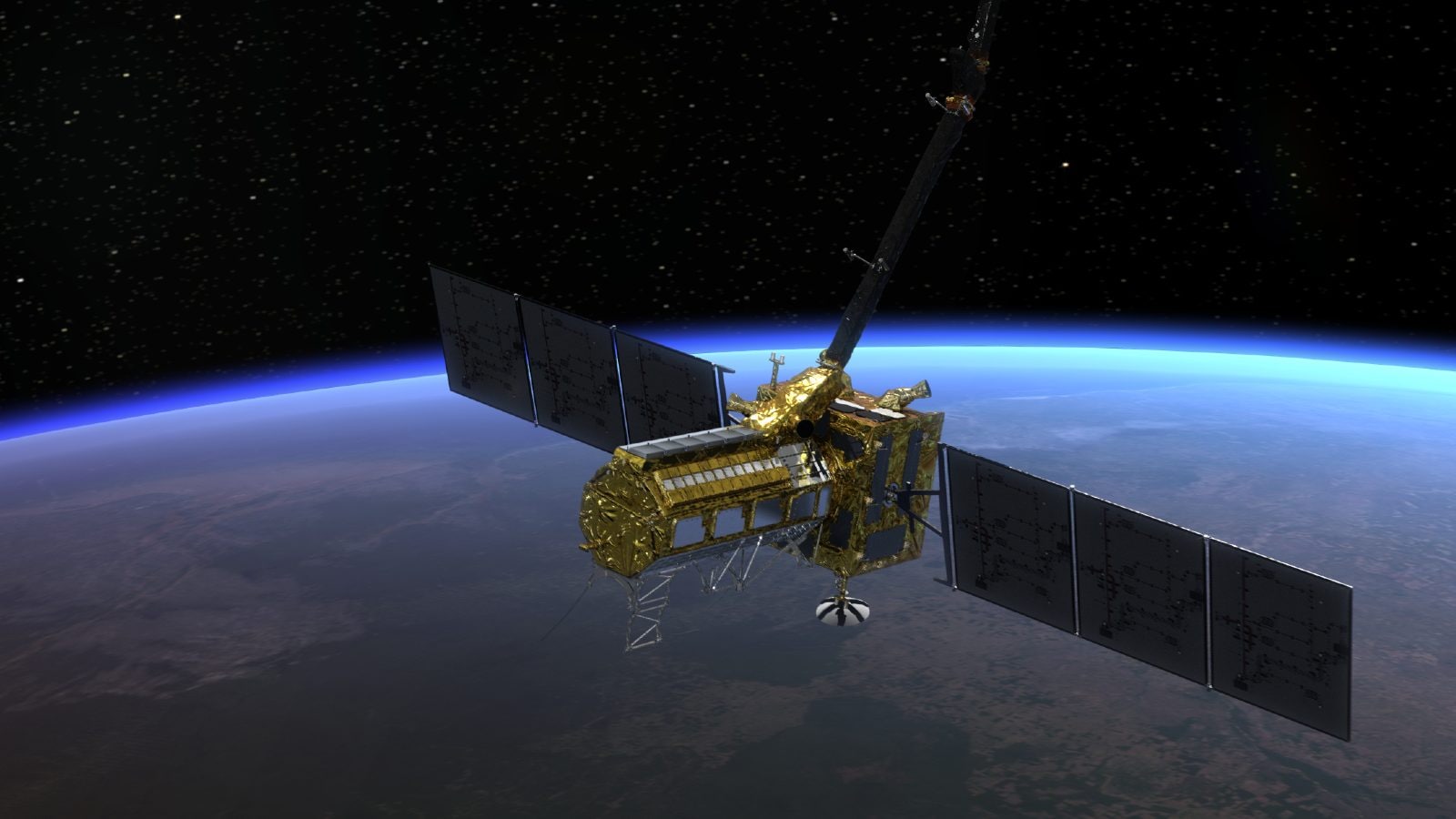
An artist’s rendering of the Nasa-Isro jointly developed NISAR satellite which will be launched in September this year (Image: Nasa)
NISAR is the first major joint venture in the satellite segment where Indian and American space agencies, Isro and Nasa, have collaborated.
After almost a decade, the work on the long awaited joint India-US project to build one of the most advanced and expensive earth observation satellites, NISAR, has been completed, the Times of India said in a report.
The Times of India report said that the dual-band payload will be flagged off from Nasa’s Jet Propulsion Laboratory (JPL) in the US for India on February 1.
The satellite, which weighs around 2.8 tonnes, will be launched from Sriharikota later this year in September. The Times of India report said that the payload will be flagged off from JPL, California by Indian Space Research Organization (ISRO) chairman S Somanath on Wednesday and it will be sent to Bengaluru’s UR Rao Satellite Centre in Bengaluru.
Once it reaches Bengaluru, it will be integrated with the satellite and then to Sriharikota, from where it will be launched in September, people familiar with the developments told the Times of India.
The NASA-ISRO Synthetic Aperture Radar (NISAR) cost an estimated $1.5 billion. NISAR can measure the planet’s changing ecosystems, ice sheet collapses, rise in sea level, depletion of groundwater levels, raise tsunami and volcanic eruptions alerts.
Isro and Nasa came together to build the NISAR satellite in September 2014. The Times of India report said that India sent its S-band SAR payload to integrate it with the US-built L-band.
NISAR, once launched, will observe Earth’s land and ice-covered surfaces globally every 12 days and sample the planet on average six days, the Times of India said, quoting Nasa.
The satellite will have a mission life of minimum three years. It will also use its advanced radar imaging to map the elevation of land and ice masses four to six times every month.
NISAR will reveal information regarding the evolution and state of Earth’s crust and allow scientists to better understand climate change and also help during natural disasters using information provided by the satellite.
Nasa has provided NISAR with the L-band SAR, a high-rate telecommunication subsystem for scientific data GPS receivers, a solid-state recorder and a payload data subsystem, the ToI said in its report. Isro has provided NISAR with a satellite bus, an S-band SAR, launch vehicle (GSLV Mk II) and other launch services.
Read all the Latest News here
For all the latest world News Click Here