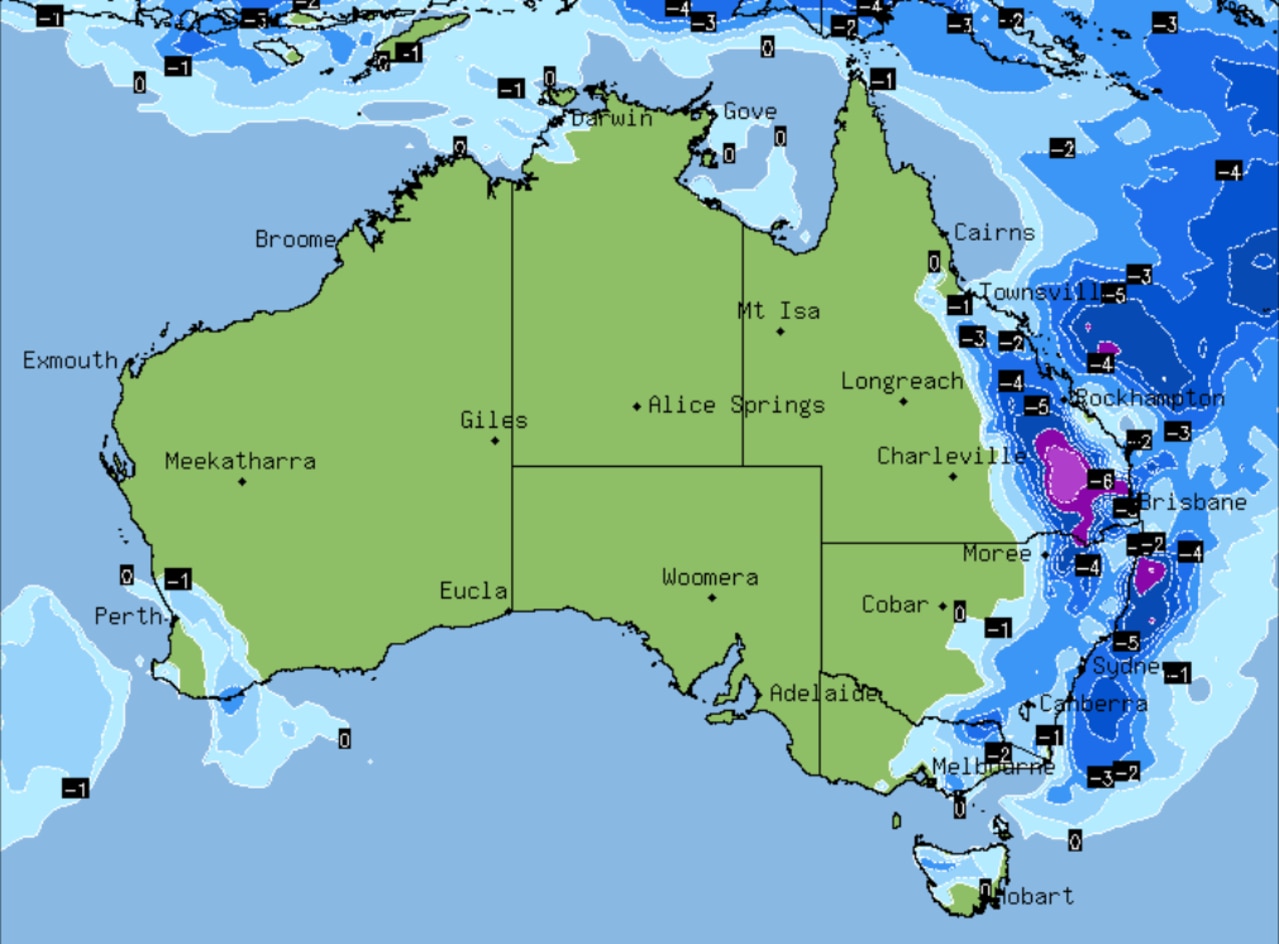
Where ‘supercell’ storm will hit hardest
East coast residents have been warned a “supercell” storm was on the way. Here’s where it will hit the hardest.
Severe storms and potentially large hail are set to lash the east coast on Thursday afternoon as a ‘supercell’ low pressure system moves in from South Australia.
Residents in Sydney, Brisbane and Canberra are encouraged to brace for heavy rain, strong winds and hail, with flash flooding also a concern.
The severe weather is fuelled by a low-pressure system which has moved from the west of the country, through South Australia and into eastern Australia.
Weatherzone meteorologist Esteban Abellan said residents in NSW, the ACT and Queensland should prepare for severe storms and flooding.
“A deep trough is moving over eastern NSW and eastern Queensland and it’s moving very slow, which means it is going to generate severe weather today and tomorrow,” he told NCA NewsWire.
“Large hail, heavy remain and damaging wind gusts should be reaching the coast later in the day in Sydney, while afternoon storms should also be firing up in Canberra and Brisbane.”
The storms are expected to be felt across much of the east coast but northern NSW and Queensland are expected to be hit the hardest.
The Bureau of Meteorology is predicting up to 45mm of rain to fall in Brisbane across Thursday and Friday.
Large parts of Victoria can also expect heavy rain, as well as eastern Tasmania. Rain in Victoria is set to last into next week.
The same supercell wreaked havoc in Adelaide on Tuesday and Wednesday, which was drenched by heavy rain and massive hail from Barossa to Balhannah.
About 50mm of rain fell between 1pm to 2pm at Mount Lofty on Wednesday.
For all the latest Technology News Click Here

