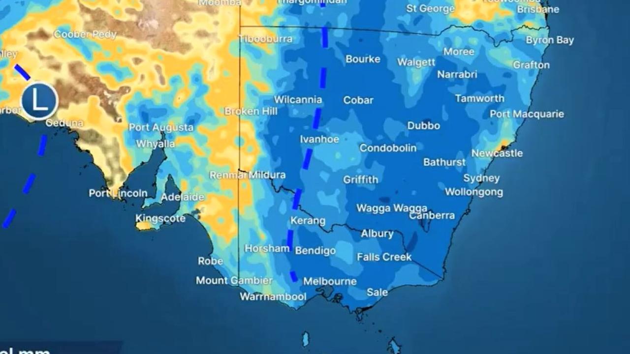
Warning wild weather ‘far from over’
The intense low pressure system that has smashed the east has a sting in its tail, with more rain and a wintry blast that will see temperatures plummet.
The intense low pressure system that has smashed eastern Australia may be heading away towards the coast but its effects are “far from over,” meteorologists have warned.
The system has a sting in its tail too – it may be on the way out but it will turn around and head straight towards Victoria.
In addition, southerly winds will see the mercury plummet to 15C below average in the south east as a wintry blast powers through.
Almost 100mm of rain fell in parts of New South Wales in the 25 hours to 9am Friday including for Newcastle.
The NSW State Emergency Service said there had been 300 requests for helps on Thursday and into Friday with nine rescues mostly from cars in swollen rivers. Areas around Orange, Bathurst and Young were the most affected.
“Many towns in regional Queensland through to the NSW central west have seen either the heaviest rain in months or years, or a month’s worth of rain in a day,” said Sky News Weather meteorologist Alison Osborne.
“It’s far from over in the south east with the low pressure system and its associated fronts sweeping toward southern Victoria.
“The winds will generate persistent rain over the state with the catchments already saturated.”
Multiple flood watches and warnings are in place up and down the eastern states.
The low pressure system will pull south on Friday and into the weekend bringing those wet conditions towards Victoria. However, Ms Osborne said a rain band covering almost the entire Queensland coast could still “pack a punch” on Friday bringing storms and heavy rainfall.
Thunderstorms for Queensland
A severe thunderstorm warning is in place from Gympie to north of Rockhampton.
Storms are also a possibility in Brisbane with up to 25mm of rain on Friday and a top of 30C.
A windy Saturday should flush out the remaining rain leading into a sunny and warm few days ahead.
Rain in NSW and ACT
The BOM has said that Gunnedah, Tamworth and Scone were among the places to get a month’s worth of rain in just the last few days in NSW.
Tamworth will continue to see showers until the end of Saturday, as will Gunnedah and Scone. But the falls could be heavier towards the coast with storms possible for Byron Bay.
The heaviest rain, however, will be in the state’s south. Merimbula is looking at persistent falls with up to 50mm on Saturday. Wagga will also be wet.
Sydney could rack up another 15mm on Friday before the wet weather recedes for the weekend. Maximums will be around 23C for the coming days with 13C minimums.
Stormy in Canberra with some heavy falls today and a possible 15mm tomorrow. A few showers on Sunday will continue but the soggy weather should slowly slide away. Highs in the capital of 16C on Friday and just 12C on Sunday.
Drenching for Victoria, cold temperatures
Crossing into Victoria and Gippsland is already seeing the rain and it will continue until at least Saturday afternoon as that system swerves in from the Tasman.
The Bureau has a severe weather warning in place for heavy rainfall over the region.
Melbourne could see up to 30mm of rain up until the end on Saturday and then more showers on Sunday and into next week.
Ms Osborne said temperatures would be “cold and wintry” for the south east and up to 15C below average for Melbourne. Indeed, the city is forecast to see highs of just 15C for the coming days and a dawn low of 7C on Sunday.
Alpine snow is likely in Victoria and Tasmania.
Some rain for Hobart but not as wet as elsewhere with around 10mm for Friday and 5mm for the coming days. Chilly in Tassie too with 13C on Saturday and 12C on Monday. Minimums could be as low as 5C.
Showers continuing in Adelaide but it shouldn’t be as heavy as in other southern states. Mild in the city with highs reaching just 17C.
Very settled in Perth with a warm weekend peaking at 31C on Saturday and lows of 14C. That means at the dead of night on Saturday, Perth will be about as warm as Melbourne is at the height of the day.
Stormy and 35C on Darwin with 15mm or rain on Friday.
For all the latest Technology News Click Here

