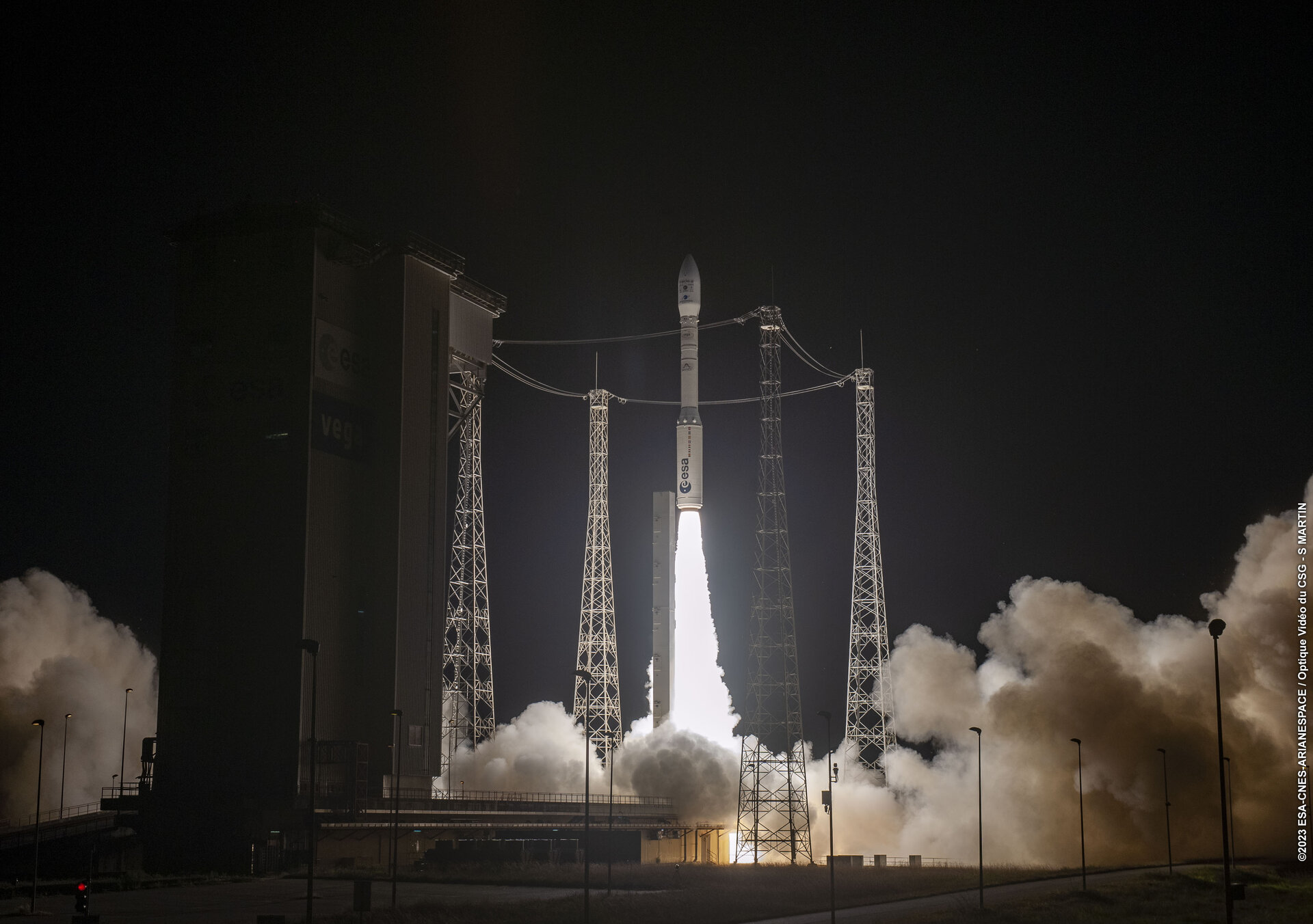
Vega flies to bring satellites to space
09/10/2023
9195 views
77 likes
In brief
Today at 22:36 local time (02:36 BST, 03:36 CEST) the 23rd Vega flight saw its two main satellites launched and released into Earth orbit. The rocket’s main passengers were the Earth observing THEOS-2 satellite and the meteorological satellite Triton.
In-depth
THEOS-2 (THailand Earth Observation System-2) is an observation satellite manufactured by Airbus for the Geo-Informatics and Space Technology Development Agency of Thailand. THEOS-2 is the largest of the two satellites in the series and will provide the Ministry of Agriculture of Thailand with information on water resources, weather and land use for planning and management.
Triton (formerly known as FORMOSAT-7R) is a Taiwan Space Agency (TASA) satellite that will collect signals that bounce off the sea surface to help scientists calculate wind field over our oceans. This data will be shared with Taiwan’s Central Weather Administration, contributing to the forecast of typhoon intensity and their trajectory.
The satellites were released in a sun-synchronous orbit, meaning they will fly over the same spot on Earth at the same time each day – following the Sun. The satellites are now free flying and being checked out for operations.
Vega
Vega is ESA’s small launcher – first launched in 2012 – specialising in placing medium-sized satellites into low Earth polar orbits that are ideal for scientific and Earth observation missions as well as ride sharing – putting multiple satellites into orbit on a single flight. It is a separate launch vehicle from the newer Vega-C and the two launchers share only one stage-type between them.
On this commercial flight, ten smaller secondary satellites were set to be released into orbit around 50 minutes after the two main passengers. All separation commands were properly executed and confirmation of the separation was acquired for eight satellites, the separation of the last two cubesats is still to be confirmed.
The five secondary missions that ESA was involved in are summarised below:
Large vegetation scanning, in a miniature format
The Proba-V Companion CubeSat will fly at 564 km altitude to perform co-observations of global vegetation with Europe’s two Copernicus Sentinel-2 satellites, which are similarly optimised for land cover and vegetation. Comparable to the Proba-V satellite that was launched in 2013, its younger sibling is much smaller and will fly at a slightly different orbit.
Pretty cool
The PRETTY (Passive REflecTomeTry and dosimetry) CubeSat will demonstrate using global navigation system signals that bounce of Earth allowing the satellite to measure sea ice amongst other things. The single cubesat is made of just three 10 cm cubes.
Small platforms, big ideas
Managed on behalf of the European Commission by ESA’s small satellite platform unit, three missions on this Vega launch are allowing for the early orbital testing of new technologies to make Europe’s space sector more competitive.
∑yndeo
Among the smallest passengers are also the most ambitious in nature: twin miniaturised laboratories, or CubeSats, for the in-orbit demonstration of disruptive, state-of-the-art space technologies. The seven test payloads aboard the European Commission-supported CubeSat Carrier (CSC) satellites, ∑yndeo-1, and ∑yndeo-2, include an innovative plasma jet pack and an ultra-sensitive magnetic instrument. The latter is planned for ESA’s future LISA constellation, which will need to maintain a precise position in deep space in order to detect the nearly imperceivable passage of gravitational waves.
Estonia’s electric space sail
The shoebox-sized ESTCube-2 will survey Estonian vegetation and be the first in-orbit test of an ‘e-sail’ tether. This will be deployed to brake the CubeSat’s orbit and accelerate its end of life, helping to keep space clear of dangerous debris.
The electric sail is a 30-m long interweaved aluminium tether line that measures just half a millimetre in thickness – around the diameter of the average human hair. Running a charge along it will generate momentum, causing it to act as a ‘plasma brake’ as opposition from Earth’s magnetic field makes it slow down in its orbit and lose altitude.
Three formation flyers
Advanced Nanosatellite Systems for Earth-observation Research (ANSER) – is a cluster of three CubeSats which will work together in close vicinity as if they are a single satellite. The satellites are in orbit around 500 km altitude, maintaining a formation at around 10 km from each other. Instead of controlling formation with fuel and engines they will deploy a set of flaps and use the trace amounts of air at the top of the atmosphere to either drag themselves downward or lift themselves upward and sideways.
Together they will image Earth in visible and near infrared offering insight into the suspended contents of water bodies, including pollution levels or the presence of toxic microorganisms such as harmful phytoplankton blooms.
For all the latest Technology News Click Here

