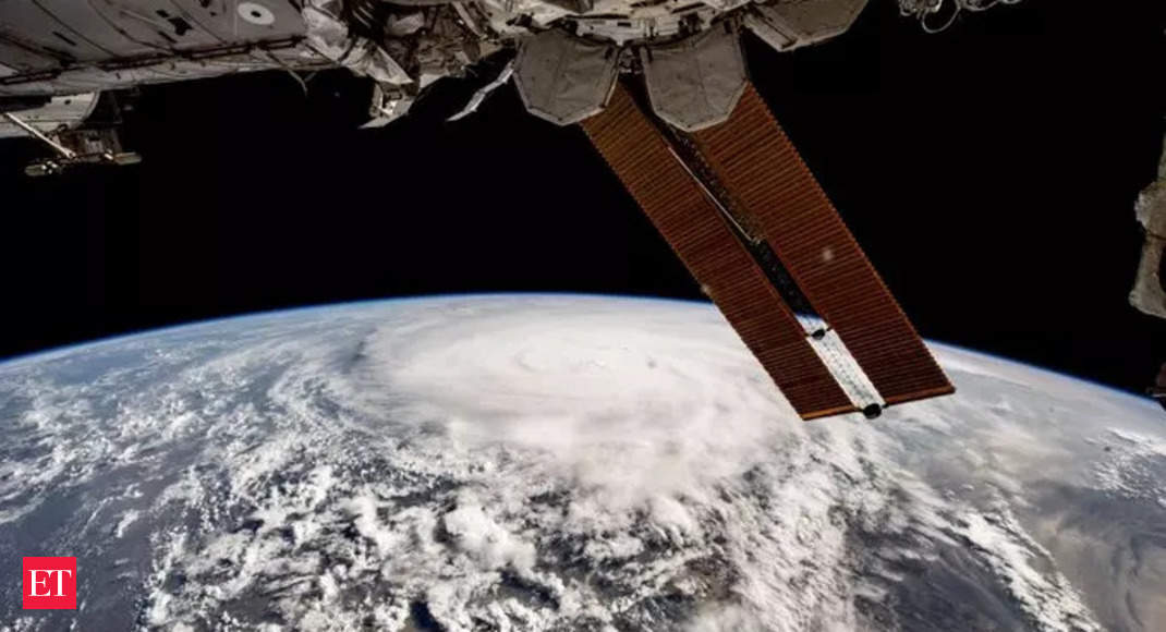
Breathtaking View: Check how cyclone Biparjoy looks from the space
“As promised in my previous video, here are some pictures of the cyclone #Biparjoy forming in the Arabian Sea that I captured over two days from the International Space Station,” Al Neyadi wrote.


Just two days ago, Al Neyadi shared a video illustrating the formation of the colossal storm over the Arabian Sea as it advanced towards the Indian coastline.
“The ISS provides a unique perspective on several natural phenomena, which can assist experts on Earth in weather monitoring, he tweeted back then.
Cyclone Biparjoy is anticipated to make landfall near the Jakhau coast of Gujarat in the evening of June 15, traversing the entirety of the Rann of Kutch up to Rajasthan.
According to the India Meteorological Department (IMD), the very severe cyclonic storm Biparjoy is expected to cross Saurashtra and Kutch, reaching the Pakistani coasts between Mandvi and Karachi near Jakhau Port by this evening.
“VSCS Biparjoy over Northeast Arabian Sea at 0230 hours IST of 15th June, 2023 about 200 km west-southwest of Jakhau Port (Gujarat). To cross Saurashtra & Kutch and adjoining Pakistan coasts between Mandvi and Karachi near Jakhau Port by evening of 15th June as a VSVS,” tweeted IMD.
The cyclone, named “Biparjoy,” which translates to “disaster” in Bengali, was initially classified as a Category 2 hurricane on Wednesday but has since weakened to a strong tropical storm. As of Thursday morning, it exhibited sustained winds of 69 mph and gusts up to 86 mph in Pakistan and India, as reported by the Joint Typhoon Warning Center. Previously, it had been moving with hurricane-force winds.
For all the latest world News Click Here

