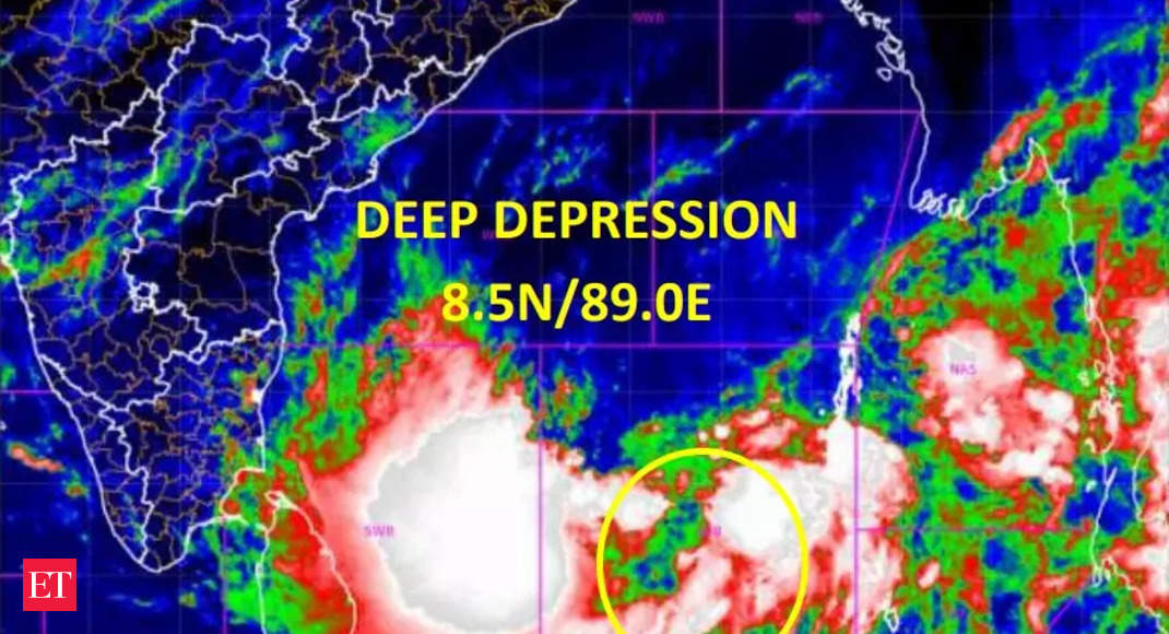
Deep depression formed over southeast Bay of Bengal, says IMD. Heavy rain predicted in many states
Sittwe (Myanmar), according India Meteorological Department.The weather department said that the cyclone is very likely to move northwestwards for some time and then north-northwestwards and intensify gradually into a cyclonic storm over the same region around today evening. Then, the cyclone is likely to intensify further into a severe cyclonic storm by 11th May morning and very severe
cyclonic storm by 11th May mid-night over southeast and adjoining central Bay of Bengal, the IMD said.
The severe cyclonic storm is likely to recurve gradually, move north-northeastwards and weaken slightly from 13th May and cross southeast Bangladesh and north Myanmar coasts between Cox’s Bazar (Bangladesh) and Kyaukpyu (Myanmar) around forenoon of 14th May, 2023 with maximum sustained wind speed of 110-120 kmph gusting to 130 kmph, the weather department said.
As a result of the cyclone, heavy to very heavy rainfall is predicted at isolated places on Andaman & Nicobar Islands till 11th May. Heavy rainfall at isolated places over Andaman Islands is likely on 12th May.
North-eastern states Tripura and Mizoram are likely to see heavy rainfall at many places with on 13th May and heavy to very heavy rainfall at isolated places on 14th May.Nagaland, Manipur, east Arunachal Pradesh and south Assam any see rainfall at many places with Heavy rainfall at isolated places is on 14th May, the weather department said.
Wind warning
Southeast Bay of Bengal: The weather department has forecast gale wind speed reaching 90-100 kmph and then gusting to 110 kmph from 11th morning and becoming 120-130 kmph gusting to 140 kmph by 12th morning and decrease thereafter.
Eastcentral Bay of Bengal: Wind speed up to 160 kmph is predicted on 13th May, and then expected to gradually decrease.
For all the latest world News Click Here

